Reach Every Door in Cambridgeshire
Targeted leaflet distribution across every postcode sector in Cambridgeshire — backed by real household data and transparent, campaign-specific pricing.
Real Household Data
Census-backed statistics on household composition, employment, and education — so you can target with precision.
Full County Coverage
Every postcode sector across Cambridgeshire is available. Target a single district or blanket the entire county.
Bespoke Pricing
Quick quotes built around your specific requirements by our UK-wide network of distributors - no hidden fees, no surprises.
The Smarter Way to Get Noticed
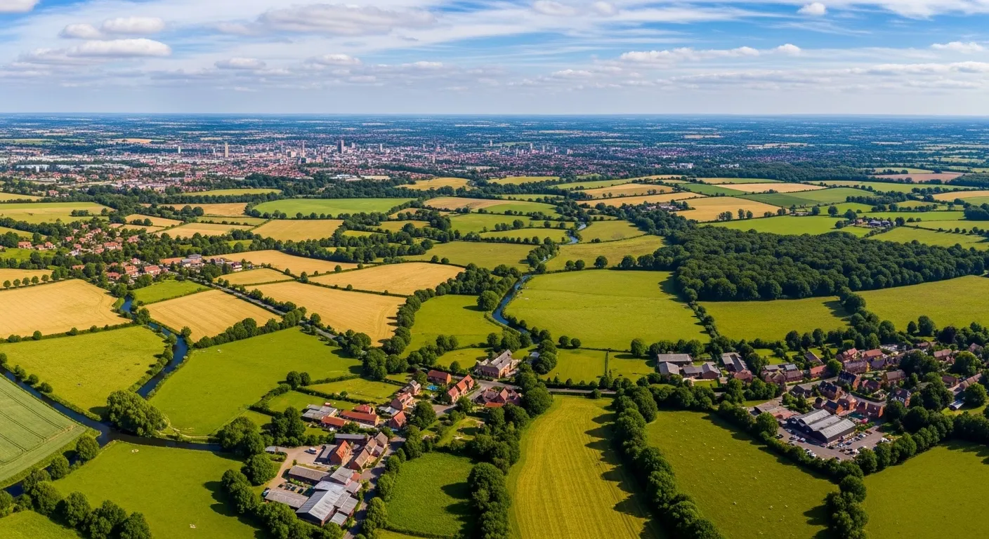
Nearly two thirds of Cambridgeshire's 433,333 households are single family homes, spread across 29 districts and 116 postcode sectors — a county that looks uniform on a map but behaves very differently depending on where you're delivering. The Cambridge city catchment attracts a highly educated, professional demographic, while the surrounding market towns and fenland communities represent a distinct and equally valuable audience. Leaflet distribution Cambridgeshire works best when it's planned at that granular level, which is exactly what Marketize's census-based targeting and GPS tracked leaflet distribution make possible.
For businesses, door to door leaflet distribution Cambridgeshire through Marketize means every postcode sector targeted is tracked, verified, and reported — no guesswork, no disputes. For individuals looking for flexible local work, the county's mix of urban and semi-rural areas generates steady campaign demand that fits around your own schedule. Targeted leaflet distribution here rewards consistency — and Marketize gives both sides the tools to deliver it.
A 94.57% employment rate across the working-age population signals strong, reliable consumer spending power — good news for trades, home services, and food businesses running flyer delivery Cambridgeshire campaigns. The high educated percentage of 82% suggests benefit-led, specific messaging will land better than broad offers, particularly in and around Cambridge itself where residents tend to read before they act.
Household Composition
Census-derived household data for Cambridgeshire. We have embedded this into our mapping software to allow you to understand your audience and make informed decision before planning distribution.
Single occupant dwellings — including young professionals, retirees, and solo renters.
Couples with or without children — the backbone of residential communities.
Shared houses, multi-generational homes, and other non-traditional living arrangements.
Employment & Education
Demographic insight on the working population and education levels across Cambridgeshire.
Part-time or full-time, employee or self-employed — a high-value audience with regular disposable income.
Working-age residents currently without paid work, available and actively seeking employment.
Residents who have obtained any level of formal education — from school qualifications to higher education.
Residents with no formal qualifications — useful for tailoring message complexity and channel selection.
Leaflet Distribution Pricing in Cambridgeshire
Pricing is tailored to your campaign — not a flat rate. Here's what shapes your quote.
Tailored to Your Campaign, Not a One-Size Price
Leaflet distribution pricing is flexible by design. Rather than a single fixed rate, costs are calculated based on a combination of factors unique to your campaign — so you only ever pay for exactly what your distribution requires.
Use our online platform to build your campaign, select your target postcode sectors within Cambridgeshire, and receive an instant, transparent quote with no hidden charges.
Get a quote on our platform →Target Area & Reach
Costs vary based on how many households you reach and across which postcode sectors. A wider spread may affect per-unit rates.
Leaflet Size & Weight
The format, size, and weight of your printed material directly influences costs. Heavier or larger items carry a higher per-delivery rate.
Volume & Quantity
Larger print runs typically unlock lower per-unit costs. Bulk campaigns covering entire districts offer the best value.
Timing & Scheduling
Delivery windows and campaign urgency can influence the final price. Flexible scheduling helps keep costs down.
Districts, Sectors & Coverage
A full breakdown of every postcode district and sector within Cambridgeshire, with the towns and localities each one covers.
Book Your Campaign in Cambridgeshire
Select your postcode sectors, upload your leaflet, get an instant quote, and schedule your drop — all in minutes on our platform.
Related Counties We Cover
Browse a list of neighbouring counties in the region. Every area below is available for leaflet distribution.
- Arlesey
- Bedford
- Biggleswade
- Dunstable
- Henlow
- Leighton Buzzard
- Basildon
- Benfleet
- Billericay
- Bishop's Stortford
- Braintree
- Brentwood
- Abbots Langley
- Ascot Road
- Baldock
- Berkhamsted
- Borehamwood
- Breachwood Green
- Attleborough
- Cromer
- Dereham
- Diss
- Downham Market
- Fakenham
- Aldeburgh
- Beccles
- Brandon
- Bungay
- Bury Saint Edmunds
- Eye